
Jonathan Smith runs Where2walk, a walking company in the Yorkshire Dales.
Jonathan has written his own book, the Dales 30 which details the highest mountains in the Dales.
He also runs one-day navigation courses for beginners and intermediates. Join his Learn a Skill, Climb a Hill weekends in the Dales.
To find out more details on any of the above visit his website, where2walk.co.uk
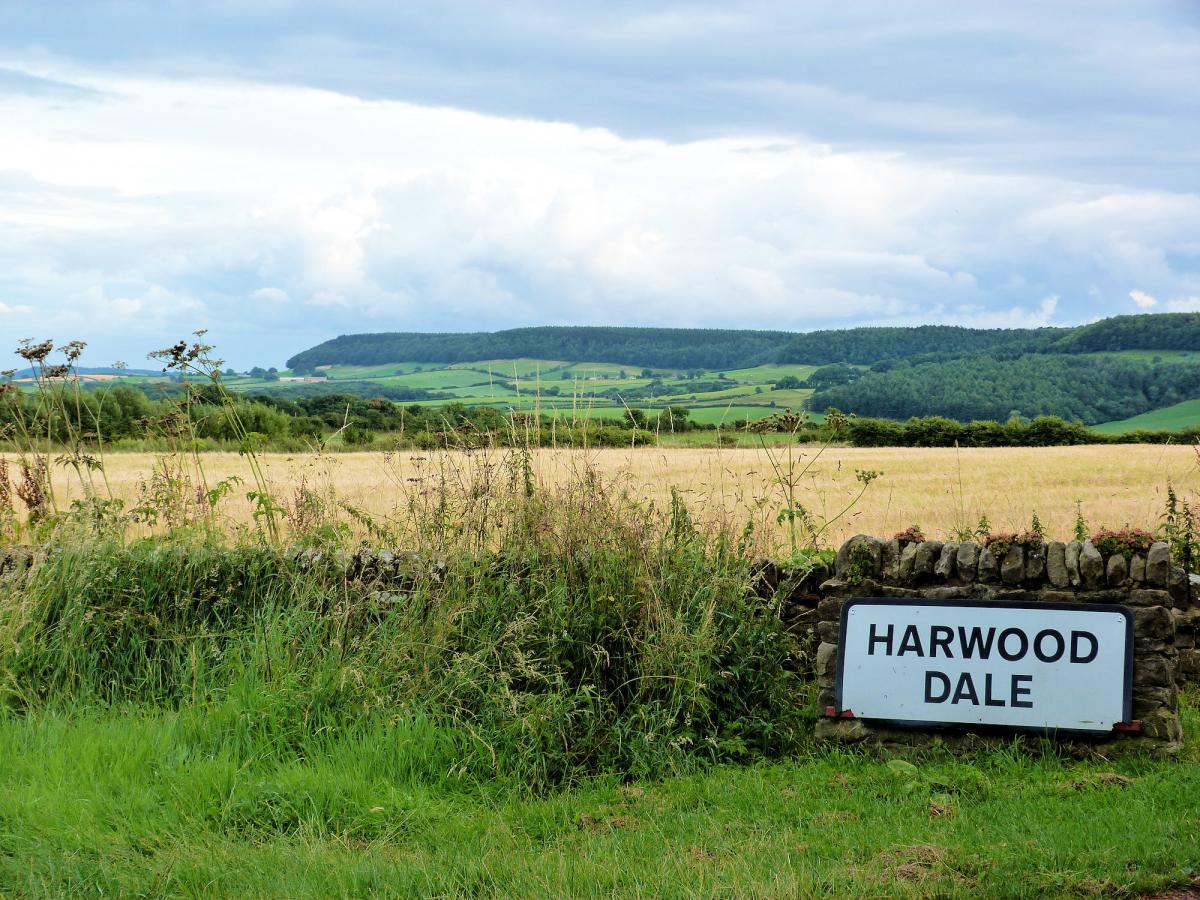
I DISCOVERED Harwood Dale on a visit to Scarborough.
It is a genuinely hidden place, not really a dale more of a forgotten landscape.
The walking is pleasant and varied and I thoroughly enjoyed exploring the paths.
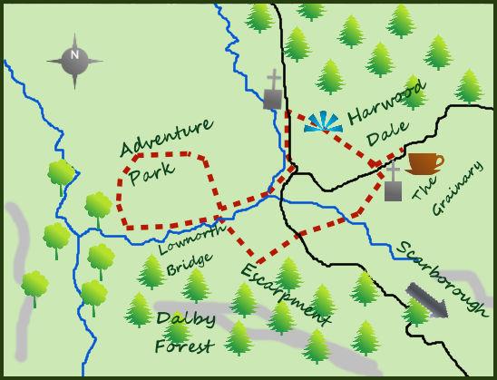
Harwood Dale itself is not easy to find. From Burniston north of Scarborough take a left hand turn off the A171 and follow the unclassified, but pleasant, road for nearly four miles to the church in the small array of houses that make up Harwood Dale.
St Margaret’s Church is modern, built in 1862, to replace the chapel ruins 1 mile to the north west. It is well set in open countryside.
Park near the church and head north to a road bend, take to the lane directly ahead. After 300 metres a path crosses the lane, take the left fork and head across fields and alongside a wall for half a mile to meet a road opposite the old church. It is worth having a good look round.
Head south along the road past the Mill pub to a junction in the road. Turn right, then right again along a minor road and head west to Lownorth Bridge. To the right of the bridge is the remains of a Bailey Bridge, installed to serve the nearby military camp.
The present stone bridge is on a bend so maybe that is why it was built. Just past the bridge a lane heads off to your left alongside Harwood Beck.
The lane leads to a cycle/adventure park. From the far end of the park I climbed north along the public right of way and returned via some of the cycle tracks to Lownorth Bridge. It certainly adds something different to the walk!
From the south side of Lownorth Bridge a bridlepath climbs steeply south in to some attractive woodland. Above the woodland and before reaching the heavier and less attractive looking forestry a footpath heads east along the side of the escarpment.
The views north over Harwood Dale are superb, a picturesque scene. To the north the forest overlooks and encloses the dale.
This is the northern fringes of the large and dense Dalby Forest, one of the largest areas of forestry in Yorkshire. However it is also used as an adventure playground with many tracks and cycling routes.
After 400 metres the path crosses a wall and starts to drop back down in to the dale. It soon reaches a road. Cross the road and the path continues through farmland to Keas Beck. Turn right for 150 metres, cross the streams to its north side and then continue heading just north of east. The path and Keas Beck arrive at a farm track.
Turn left on the track and follow it back the short distance to the church. The Grainary at Keasbeck Hill Farm with its excellent café is half a mile along the road to the east.
Fact File:
Distance: Roughly six miles.
Height to Climb: 330m (1,080 feet)
Start: SE 962958. Park on the road near the church. Alternatively the Grainary may allow you to park there, but do ask and do pop in for tea and cake afterwards!
Difficulty: Easy/Medium. Some rougher paths and a couple of short uphill sections.
Refreshments: The Grainary café at Keasbeck Hill Farm.
Be Prepared:
The route description and sketch map only provide a guide to the walk. You must take out and be able to read a map (O/S Explorer OL27) and in cloudy/misty conditions a compass. You must also wear the correct clothing and footwear for the outdoors. Whilst every effort is made to provide accurate information, walkers head out at their own risk.
Please observe the Countryside Code and park sensibly.


Comments: Our rules
We want our comments to be a lively and valuable part of our community - a place where readers can debate and engage with the most important local issues. The ability to comment on our stories is a privilege, not a right, however, and that privilege may be withdrawn if it is abused or misused.
Please report any comments that break our rules.
Read the rules hereComments are closed on this article