
Jonathan Smith runs Where2walk, a walking company in the Yorkshire Dales.
Jonathan has written his own book, the Dales 30 which details the highest mountains in the Dales.
He also runs one-day navigation courses for beginners and intermediates. Join his Learn a Skill, Climb a Hill weekends in the Dales.
To find out more details on any of the above visit his website, where2walk.co.uk
THIS is my favourite walk out of Richmond.
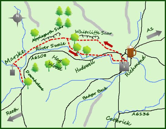
Whilst most keep to the river around the castle, I prefer the escarpment above Richmond with its views and easy walking terrain. Marske is an interesting bonus. Stick high on the outbound leg, returning via the river.
Leave Richmond on the main road heading west and just after a second sharp kink in the road (167011) follow a minor road heading uphill. After 250m and leaving the houses on either side the road turns in to a wide track. There is a sign here for the Coast to Coast heading back to Richmond.
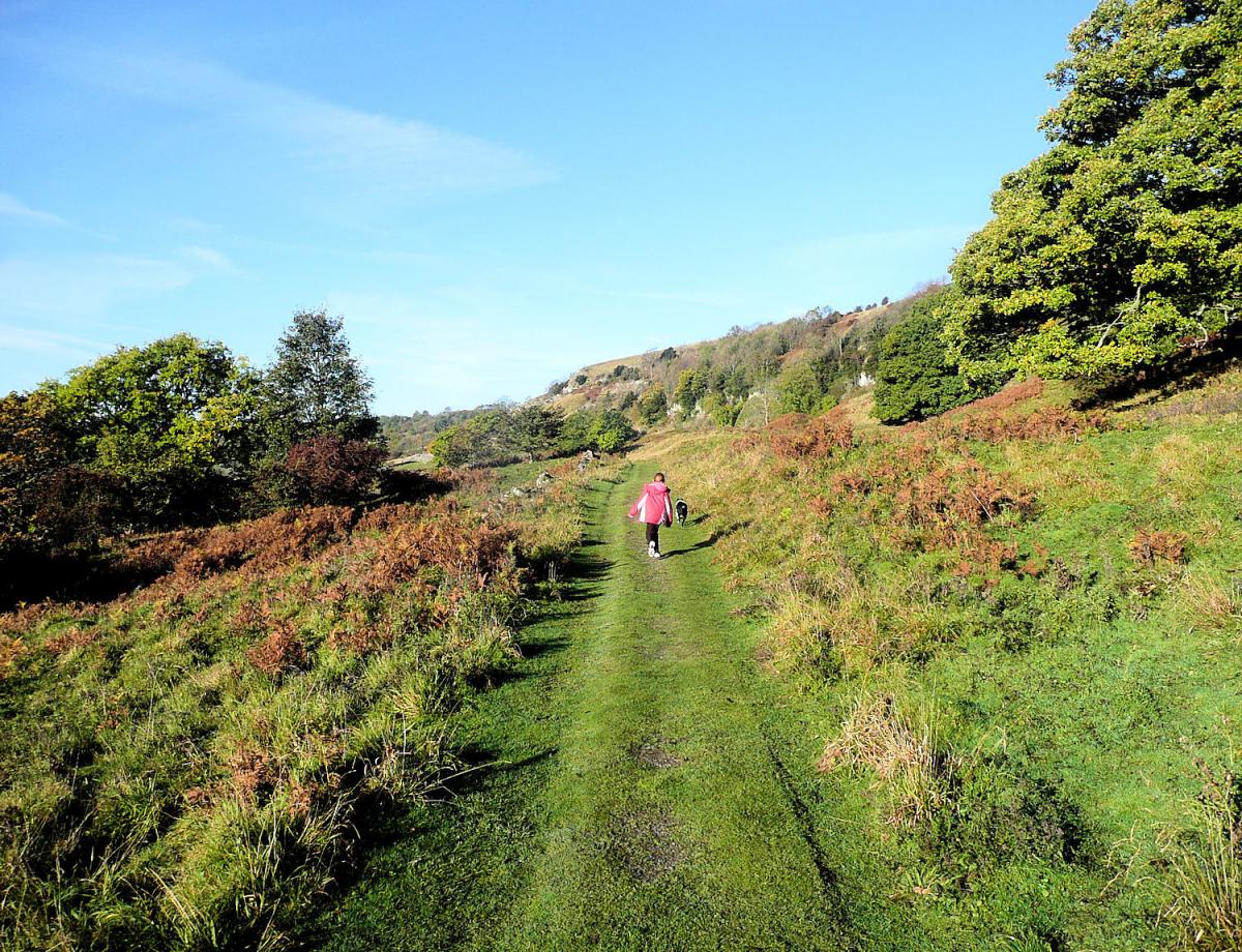
As with most long distance trails, the Coast to Coast is only signed one way - in this case I do not agree. The C2C is best walked from the east towards the west, ending in the Lake District. Follow the lane as it gradually climbs and turns west, enjoying the views south over the River Swale.
After one mile the track enters Whitecliffe Wood, just beyond the farm of High Leases. This ancient and mixed woodland is an enjoyable half a mile variation from the previous farmland walking.
Soon after emerging from the woodland a short path goes directly up hill to the ground remains of an ancient Breton fort. It is worth the detour but return to your main track and carry on a few hundred metres to East Applegarth Farm. From here the track becomes a footpath but carries on at a similar height, contouring the two escarpments above.
After Whitecliff Scar is Applegarth Scar, both signifying the remains of the most recent glacier that retreated only 15,000 years ago exposing the limestone bedrock.
From West Applegarth Farm the path return to a farm track, follow it for half a mile before taking the footpath downhill (leaving the track) through the fields in to Marske. The attractive village of Marske was once the centre of a large mining community, probably going back all the way to Elizabethan times, certainly the bridge does.
Marske Hall itself has a colourful history (but difficult to get at through the trees) and there is a pretty church and village hall (if you are lucky they will be serving tea).
The Little White Bus stops at the Vicarage at Downholme 1 mile away on the River Swale but better is to return via the outbound route to the farm at Low Applegarth.
Just before arriving at a dry stone wall a path heads south/then east downhill through the fields to the banks of the River Swale. This whole area was flooded last year and can be wet in places but offers an interesting three miles back to the caravan park on the outskirts of Richmond.
Fact File:
Distance: Roughly 10 miles (6 miles to the bus stop at Downholme)
Height to Climb: 400m (1,310 feet)
Start: NZ 169011. There is plenty of car parks in Richmond with street parking on the outskirts.
Difficulty: Medium/Hard. Some climbing to the escarpment but generally on good tracks and paths.
Refreshments: Richmond has all the facilities of a large town.
Be Prepared:
The route description and sketch map only provide a guide to the walk. You must take out and be able to read a map (O/S Explorer 30) and in cloudy/misty conditions a compass (essential on this walk). You must also wear the correct clothing and footwear for the outdoors.
Whilst every effort is made to provide accurate information, walkers head out at their own risk.
Please observe the Countryside Code and park sensibly.


Comments: Our rules
We want our comments to be a lively and valuable part of our community - a place where readers can debate and engage with the most important local issues. The ability to comment on our stories is a privilege, not a right, however, and that privilege may be withdrawn if it is abused or misused.
Please report any comments that break our rules.
Read the rules here