
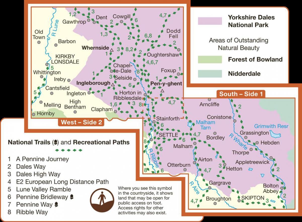
THE new 90-mile long distance walk, which starts in the World Heritage village of Saltaire and finishes in the market town of Appleby-in-Westmorland, has been added to the latest Ordnance Survey maps for the Yorkshire Dales.
A Dales High Way is one of two new routes to be included for the first time on Outdoor Leisure Map OL2 Yorkshire Dales Southern and Western Areas. It will be feature on the updated OL19 Howgill Fells and Upper Eden Valley map early next year.
The cover of the new edition of OL2 map shows the Ribblehead Viaduct under which the route of A Dales High Way passes before skirting Whernside to head through Dentdale to Sedbergh and the Howgill Fells.
Friends of A Dales High Way chairperson Julia Pearson said: “We are delighted that the route is now on the map. It will introduce more people to the pleasures of walking through the glorious Yorkshire Dales. The whole world saw how beautiful the Dales are during the Tour de France and now they want to come and see for themselves.”
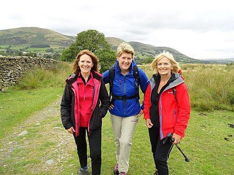
Co-creator of the trail Chris Grogan said: “Long distance walking is a great way to experience a landscape and benefits the local communities as well. Spending a few days on a trail and staying in towns and villages along the way means that walkers not only enjoy the countryside but the great Yorkshire hospitality.”
Chris Grogan will appear on BBC Radio 4’s Ramblings programme in the autumn. She walked with Clare Balding along the Dales Way from Dent to Sedbergh and talked about how the Dales Way had inspired her and husband Tony to devise their own route.
A Dales High Way website can be found at daleshighway.org.uk and the two guides to the trail – A Dales High Way Route Guide, and A Dales High Way Companion – can be bought online from the publishers at skyware.co.uk.


Comments: Our rules
We want our comments to be a lively and valuable part of our community - a place where readers can debate and engage with the most important local issues. The ability to comment on our stories is a privilege, not a right, however, and that privilege may be withdrawn if it is abused or misused.
Please report any comments that break our rules.
Read the rules here